
When the Skies Turn Dark
I will never forget the afternoon of March 12, 2026. I was working from my home office in Greenville when my phone started buzzing every few minutes. First, it was a severe thunderstorm watch. Then, twenty minutes later, a warning. Then another watch for a different county. By noon, I had received seven different alerts, and my weather app looked like a Christmas tree of red and yellow warnings. If you live in South Carolina, you probably know exactly what I am talking about.
Living in the Palmetto State means accepting that severe weather is not just a possibility; it is a reality that visits us multiple times every year. Whether you are in Columbia, dealing with afternoon pop-up storms, along the coast watching for tropical systems, or in the Upstate experiencing rapid temperature swings, understanding why multiple severe thunderstorm alerts get issued for South Carolina counties can literally save your life.
This is not just about meteorology jargon or government protocols. This is about knowing when to take your kids to the basement, when to pull over your car, and how community resilience can help us all stay safe during storms. Let me walk you through everything I have learned over fifteen years of living here, including mistakes I have made and lessons from emergency management professionals who deal with this daily.
What Actually Triggers Multiple Severe Thunderstorm Alerts
Here is something that has confused me for years: why does the National Weather Service sometimes issue five or six separate alerts for what appears to be one big storm system? The answer is more complicated than you might think, and understanding it helps you respond appropriately.
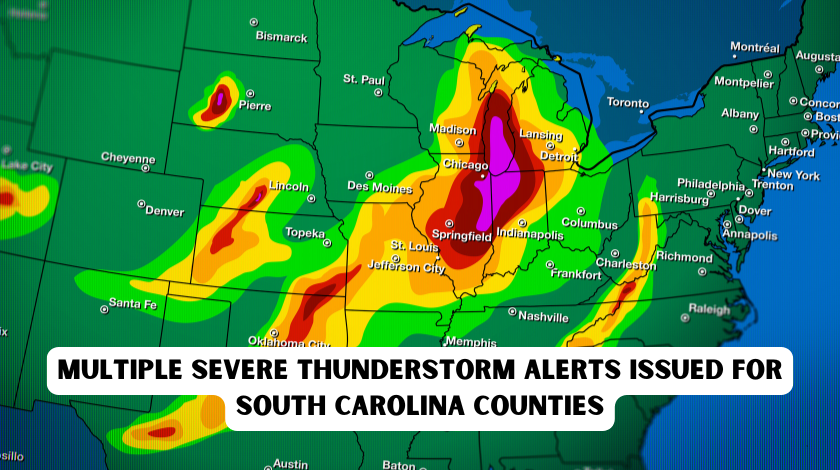
First, each thunderstorm cell is treated as an individual event. When meteorologists at the Storm Prediction Center analyze radar data, they are not looking at one massive blob of bad weather. They are tracking discrete cells, each with its own rotation, wind patterns, and potential for damage. A line of storms stretching from Anderson to Florence might contain eight or nine separate cells, any one of which could spawn damaging winds or hail. That is why your phone blows up with multiple warnings; each one represents a distinct threat.
Second, county boundaries matter more than you might expect. South Carolina has forty-six counties, and the National Weather Service issues warnings based on specific geographic areas. A storm might clip the northwest corner of Lexington County while hammering the center of Richland County. Recognizing that alerts for neighboring counties, such as Aiken or Horry, may affect your safety can help you respond more effectively and avoid unnecessary panic.
Third, storm intensity changes rapidly. I learned this during a particularly nasty system that moved through Spartanburg County last spring. The initial warning mentioned quarter-sized hail and sixty-mile-per-hour winds. Thirty minutes later, an updated warning mentioned possible tornado rotation. Then a third alert canceled the tornado threat but warned of flash flooding. These updates are not the weather service being indecisive; they are responding to real-time data as the storm evolves.
The March 2026 storm system that prompted this article actually generated multiple tornado watches and severe thunderstorm warnings across the Upstate before temperatures plunged dramatically. One minute, it was eighty degrees; the next, we were under a tornado watch. That is South Carolina weather for you.
Why South Carolina Gets Hit So Hard
If you have lived here long enough, you know that severe weather in South Carolina has its own personality. We are not talking about gentle afternoon showers. We are talking about storms that form quickly, move unpredictably, and often bring multiple hazards simultaneously.
Our geography creates a literal perfect storm. The Atlantic Ocean feeds moisture into our atmosphere year-round, but especially during spring and summer. Warm, humid air masses from the Gulf of Mexico collide with cooler air coming down from the Appalachians. When these air masses meet, the atmosphere becomes unstable, like a shaken soda bottle ready to explode. The Upstate region, where I live, experiences some of the most dramatic weather due to this topographical influence. Mountains to our west force air upward, triggering rapid storm development.
Coastal areas face different but equally serious challenges. The Lowcountry deals with tropical systems, waterspouts, and the unique hazard of storm surge combined with heavy rain. During Hurricane season, a single tropical wave can trigger multiple severe thunderstorm watches across Beaufort, Charleston, and Horry counties simultaneously.
Then there is the “false spring” phenomenon we experienced this March. Temperatures soared into the eighties, tricking plants and people into thinking winter was over. Then a cold front slammed into that warm air, creating explosive storm development. The National Weather Service issued a tornado watch for several Upstate counties at 7:14 a.m. on March 12, which expired at 1:00 p.m. as the line pushed eastward. No tornadoes touched down, thankfully, but the threat was real, and the alerts were necessary.
South Carolina averages twenty to twenty-five tornadoes annually, according to the National Weather Service, but severe thunderstorms are far more common. Every thunderstorm produces lightning, and our state sees millions of strikes yearly. Hail larger than quarters damages roofs and cars regularly. Flash flooding claims more lives than any other thunderstorm-related hazard because people underestimate the power of moving water.
Understanding Watch Versus Warning: The Critical Difference
I used to get these mixed up all the time, and I am embarrassed to admit it took me years to internalize the distinction. If you remember nothing else from this article, remember this: a watch means be prepared, a warning means take action now. Understanding this difference can help you feel more prepared and less anxious during severe weather events.
When the Storm Prediction Center issues a Severe Thunderstorm Watch for multiple South Carolina counties, it means conditions are favorable for severe storms to develop. The watch area is typically large, covering numerous counties or even crossing state lines. To stay safe, review your emergency plan, ensure your weather radio has batteries, and use GPS-enabled weather apps to confirm if your specific location is affected. But you do not need to head to your safe room yet.
A Severe Thunderstorm Warning is different. This means severe weather has been spotted on radar or reported by trained spotters. The warning area is much smaller, usually covering specific counties or portions of counties. When you receive this alert, move to a sturdy building immediately. Get away from the windows. Avoid using corded phones or electrical equipment. If you are driving, pull over safely and wait it out.
The same distinction applies to tornadoes. A Tornado Watch means tornadoes are possible. A Tornado Warning means one has been sighted or indicated by radar, and you should seek shelter in an interior room on the lowest floor immediately.
During the March 2026 event, many residents received both types of alerts. The tornado watch covered a broad area of the Upstate, while specific severe thunderstorm warnings targeted individual counties as cells developed. This layered approach helps people understand both the general risk and their immediate threat level.
How South Carolina’s Alert Systems Actually Work
You might wonder how these alerts reach your phone so quickly. The system is more sophisticated than most people realize, involving multiple layers of technology and human decision-making.
It starts with the National Weather Service forecast offices. South Carolina is served by four offices: Wilmington (covering the northeastern counties), Charleston (coastal and southern regions), Columbia (central areas), and Greenville-Spartanburg (the Upstate). These offices operate twenty-four hours a day, monitoring Doppler radar, satellite imagery, and data from weather balloons.
When meteorologists detect severe weather potential, they issue watches in coordination with the Storm Prediction Center in Norman, Oklahoma. As storms develop, local offices issue warnings based on their specific radar analysis. These warnings feed into the Emergency Alert System, which broadcasts through television, radio, and wireless emergency alerts to cell phones.
South Carolina also uses CodeRED, an emergency notification system managed by the South Carolina Emergency Management Division. Unlike the National Weather Service alerts, which are automatic, CodeRED allows county emergency managers to send targeted messages about specific local hazards. You can sign up for these alerts at your county’s emergency management website, and I strongly recommend doing so. The system can call, text, or email you, depending on your preference.
Local television stations play a crucial role, too. Meteorologists at stations like WIS in Columbia, FOX Carolina in Greenville, and Live 5 News in Charleston interpret the raw data and explain what it means for specific neighborhoods. During major events, they provide continuous coverage, tracking storms street by street.
The key takeaway is redundancy. You should have multiple ways to receive warnings because no single system is perfect. Cell towers can fail. Power can go out. Television signals can be interrupted. I keep a NOAA Weather Radio with battery backup in my bedroom, and I have the CodeRED app on my phone. Overkill? Maybe. But I sleep better knowing I will wake up if a tornado warning is issued at 2:00 a.m.
Preparing Before the Storm: Lessons from Experience
Preparation is not about paranoia; it is about practicality. After years of dealing with South Carolina storms, I have developed a routine that takes about an hour to set up but provides peace of mind all season long.
Start with your safe space. Identify the most interior room on the lowest level of your home, away from windows. For most people, this is a bathroom, closet, or hallway. Make sure everyone in your household knows where to go. If you live in a mobile home, identify a sturdy building nearby where you can shelter. Mobile homes are death traps during severe winds, and no amount of preparation inside one will keep you safe.
Build an emergency kit specifically for severe weather. Mine includes a battery-powered weather radio, flashlights with extra batteries, a first aid kit, bottled water, non-perishable snacks, and a whistle to signal for help if trapped. I also keep a pair of sturdy shoes in my safe room because walking through debris barefoot is dangerous. If you have infants, elderly family members, or pets, include supplies for them too.
Secure your property before storm season peaks. Remove dead tree branches that could fall on your home. Secure outdoor furniture that could become projectiles in high winds. Clean your gutters to prevent water backup during heavy rain. These tasks seem mundane until a storm is bearing down and you realize that patio umbrella could smash through your window.
Review your insurance coverage annually. Standard homeowner’s policies do not cover flood damage, and flooding is common during severe thunderstorms. The National Flood Insurance Program has a thirty-day waiting period, so you cannot buy coverage when a storm is already forecast. I learned this the hard way when my basement flooded in 2023.
Finally, have a communication plan. Designate an out-of-state contact that family members can check in with if local phone lines are jammed. Text messages often go through when voice calls fail, so teach children how to send location information via text.
What to Do During a Severe Thunderstorm Warning
When that warning tone sounds on your phone, your actions in the next few minutes matter immensely. Here is what I do, based on advice from emergency management professionals and my own experiences.
First, stop what you are doing and assess your location. If you are outdoors, seek shelter immediately in a sturdy building. If you are driving, pull over safely, away from trees and power lines, and stay in your vehicle. Do not park under overpasses, as wind tunnels through them and debris can collect there.
Once indoors, move to your predetermined safe room. Stay away from windows, doors, and exterior walls. Flying debris causes most injuries during severe thunderstorms, so put as many walls between you and the outside as possible. If you have a mattress or heavy blankets, use them to shield yourself from potential debris.
Avoid using corded phones and electrical equipment. Lightning can travel through wiring, and power surges are common during storms. I unplug my computer and avoid showering until the storm passes, as plumbing can conduct electricity too.
Pay attention to updates. Severe thunderstorm warnings typically last thirty to sixty minutes, but conditions can change. Keep your weather radio or phone handy for updates. If a tornado warning is issued for your area, everything changes. You need to be in your most interior room, preferably underground, protecting your head and neck.
If you are caught outside with no shelter, avoid isolated trees, hilltops, and bodies of water. Squat low to the ground on the balls of your feet, making yourself the smallest target possible. Do not lie flat, as this increases your contact with the ground and lightning risk.
After the Storm: When It Is Safe to Emerge
The moment the rain stops and the wind dies down, your instinct is to go outside and assess the damage. Resist this urge for at least thirty minutes. Severe thunderstorms often come in multiple rounds, and the calm between cells can be deceptive.
When you do go outside, watch for downed power lines. Treat all downed lines as live and dangerous, even if they appear dead. Report them to your utility company immediately. Check on neighbors, especially elderly residents who might need assistance.
Document any damage for insurance purposes. Take photos before you clean up. If you experienced flooding, be aware that mold can start growing within 24 to 48 hours, so begin drying affected areas as soon as possible.
Check local news and official social media accounts for information on road closures, boil-water advisories, or extended power outages. The South Carolina Emergency Management Division coordinates recovery efforts and posts updates on its website and social media channels.
Technology Tools Every South Carolinian Should Use
We are fortunate to live in an age where weather information is more accessible than ever. Here are the tools I rely on, beyond the basic weather app that came with my phone.
The CodeRED Mobile Alert app provides location-based emergency notifications. You can customize which alert types you receive and set quiet hours so you are not woken up for minor events. The South Carolina Emergency Management Division also offers a free app with preparedness information and real-time updates.
For serious weather enthusiasts, RadarScope provides professional-grade radar data. It shows storm velocity, precipitation intensity, and lightning strikes in real-time. It costs money, but for me, it is worth it to see exactly what is heading my way.
NOAA Weather Radio remains the gold standard for reliability. These radios automatically activate when warnings are issued for your area, even if the power is out and cell towers are down. I have a Midland model that runs on batteries and hand-crank power.
Social media can be valuable if you follow the right accounts. The National Weather Service offices for Charleston, Columbia, Greenville-Spartanburg, and Wilmington post frequent updates. Local television meteorologists often provide street-level detail that automated apps miss. Just be wary of unofficial accounts that spread unverified information or outdated warnings.
Community Resilience: We Are in This Together
Severe weather does not just affect individuals; it tests entire communities. I have seen neighbors help neighbors clear debris, share generators during extended outages, and check on elderly residents who live alone. This social infrastructure matters as much as physical preparedness.
South Carolina Severe Weather and Flood Safety Week, held annually in early March, is a great opportunity to get involved. The state conducts a tornado drill where schools, businesses, and residents practice their shelter plans. Participating might feel silly, but muscle memory matters in emergencies. When you have practiced going to your safe room, you do it automatically when the real warning comes.
Local emergency management agencies offer training programs, such as the Community Emergency Response Team (CERT) certification. These courses teach basic disaster response skills like fire safety, light search and rescue, and medical operations. Having trained volunteers in every neighborhood makes our entire state more resilient.
Businesses play a role, too. Employers should have severe weather plans that account for employees and customers who might be on-site when warnings are issued. Schools need clear protocols for quickly moving students to safe areas. Churches and community centers can serve as shelters for those who lack safe spaces at home.
Conclusion: Respect the Weather, Do Not Fear It
Living with frequent severe thunderstorm alerts is part of the bargain we make for calling South Carolina home. The same climate that gives us warm beaches, lush forests, and mild winters also produces powerful storms that demand our respect.
Understanding why multiple alerts get issued, knowing the difference between watches and warnings, and having a solid preparedness plan transforms anxiety into confidence. You cannot control the weather, but you can control your response to it.
The next time your phone buzzes with a severe thunderstorm warning for your county, you will know exactly what to do. You will know that the National Weather Service meteorologists are doing their jobs, that the technology is working as intended, and that you have prepared your family to stay safe. That knowledge is power, and in severe weather, power can mean the difference between a scary story and a tragedy.
Stay informed, stay prepared, and stay safe, South Carolina.
Frequently Asked Questions (FAQ)
Q: Why did I get a severe thunderstorm warning, but my friend in the next county did not? A: Warnings are issued for specific areas where storms are actually occurring or imminent. Your friend might be outside the warning polygon, or the storm might be moving away from their location. Always check the specific counties mentioned in the alert.
Q: How long do severe thunderstorm warnings usually last? A: Typically thirty to sixty minutes, depending on the storm’s speed and intensity. The National Weather Service updates warnings as conditions change, so stay tuned for extensions or cancellations.
Q: Can severe thunderstorms produce tornadoes without warning? A: Yes, which is why all severe thunderstorms should be taken seriously. While meteorologists can detect rotation on radar, tornadoes can form and dissipate quickly. If you feel threatened, treat the situation like a tornado warning and seek interior shelter.
Q: Is it safe to drive during a severe thunderstorm warning? A: Only if necessary. Pull over safely if visibility drops or the wind becomes dangerous. Never drive through flooded roadways, as just twelve inches of water can sweep away a small vehicle.
Q: What is the difference between a severe thunderstorm and a regular thunderstorm? A: Severe thunderstorms produce hail one inch or larger in diameter, winds of fifty-eight miles per hour or greater, or tornadoes. Regular thunderstorms might produce lightning and heavy rain, but lack these extreme elements.
Q: How can I report storm damage to the National Weather Service? A: Each National Weather Service office has different preferred methods, including phone hotlines, email, online forms, and social media. Check the website for your local office (Wilmington, Charleston, Columbia, or Greenville-Spartanburg) for specific reporting instructions.